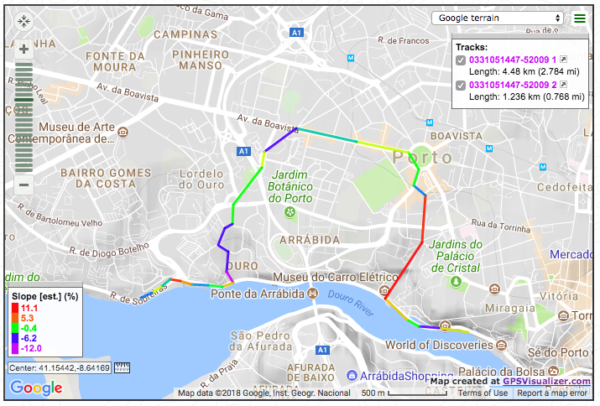
I like to ride my bicycle, specially in mountains. Being able to understand quickly with a glance to the GPS screen what lies ahead is important, so I give you this strategy to colorize the track according to its degree of difficulty slope wise. Uphill is painted with hot colors and going down is read by cool colors.

- Go to the excellent GPS Visualizer website, “Make a Map – Google Earth” option.
- In the General map parameters tab, set “Add DEM elevation data:” to “best available source”
- In the Track options tab, click “show advanced track options [+]”
- “Colorize by:” -> “Slope”
- “Custom spectrum file (URL):” -> I suggest using a gradient created by me, but you can use whichever. Paste this “https://pedroazambujavarela.net/imgs/gradient06.png”
- In the Upload your GPS data files here tab, choose your GPS track file
- Finally, click Create KML here, and click the presented file to download it.
Example: